|
|
My PICPMB Blog
|
|
I now have four weeks to get myself ready to ride the Tour Durban and continue to cruise up and down the hills in the North Western suburbs of Pietermaritzburg. I will once again record the route used here using the Tracker app running on my Nokia PureView 808 smart phone. I will also incorporate the photographs taken with the same phone during the ride. Using the Tracker app will allow me to show the profile of the ride, which should be interesting as it will be very effective in terms of illustrating the nature of the terrain one covers, if one cycles in these parts. You can view the route and profile here.
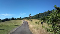
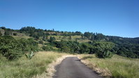
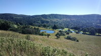
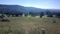
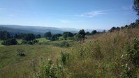
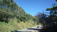
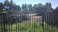
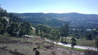
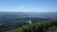
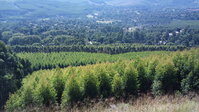
The photographs will also serve to illustrate the great natural beauty of the surroundings one cycles through, and the magnificent views the ride affords. Unfortunately the section of the route that involves Old Howick Road, reveals the extent to which PMB has deteriorated. It is also a dangerous section of the route, as the road has no shoulder and no pavement. The bush has also been allowed to grow right up to the side of the road, and in some places, into the road.
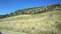
This is a great pity as the ride from the bottom of Town Hill, starting at the Dorp Spruit Bridge (altitude ~655 m) and proceeding to the summit at The Brewery (previously Crossways Hotel) (altitude ~1170 m), makes for an excellent training ride with a climb of 500 m over 8.4 km. It could also be used to stage an annual Hill Climbing Event that could enhance PMB's emerging status as South Africa's Cycling Hub! Currently there is a similar event for runners known as The Capital Climb.
 01peakinginqep *
|
 02lookingback2n3 *
|
 03tbv01
|
 04tbv02
|
 05tbv03
|
 06neatfit *
|
 07dismaldump *
|
 08wv01
|
 09tbv04
|
 10tablemountain *
|
 11howgreenismyvalley
|
It certainly would be great if a dedicated bike track existed along the route from the Dorp Spruit Bridge at the base of Town Hill along the old road, to the summit of Town Hill, at The Brewery in Hilton.
It would also be great if a proper paved sidewalk existed along the length of Town Bush Road, not so much for cyclists who could use it whilst ascending the hill, but for the various pedestrians that walk down the road in the afternoon as the head home in the face of vehicular traffic headed up the road, also carrying folk home.<\/p>
Takes a while to load, but then proceeds quite smoothly. Looses image aspect ratio for portrait images i.e., squashes them.
If you have any comments, corrections, suggestions or plain criticism, I would appreciate it if you would communicate the same to me.
|
|
[email protected] |
|
|
Google+ | www.robdempster.com |
|

